


© All rights reserved.
Beginner's Guide to Geotagging
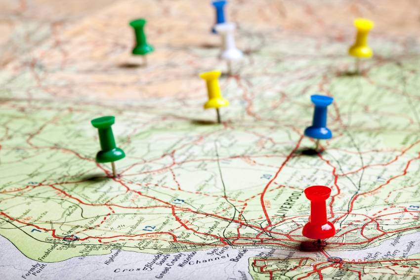
Geotagging is the process of enriching multimedia by adding data that allows it to be identified from a geographical point of view. We are talking about methods that allow us to tag digital photographs, videos, and so on. Here's a detailed tutorial that shows how to geotag your photos, for example.
Most times, the added metadata includes the latitude and longitude coordinates where the picture was taken. However, newer versions of the standard also allow the inclusion of height, date, hour and even the name of the place where a photo was taken.
It's a fantastic opportunity, because it allows you to remember the place where you've taken a picture later on, even if you have forgotten the exact location. This means that you will have the possibility to revisit a great spot, or see it again anytime you want to, virtually, by using applications such as Waze Map.
Geotagging can also be used to find local resources or news, of course. There are many services which group these kinds of resources according to their type.
The popularity of geotagging has exploded quickly after Facebook took the decision to integrate it into its services. Recently, Instagram has added this feature to its pictures as well.
Let's see how geotagging works. We will discuss the easier to understand process that is used for pictures.
There are two distinct methods that allow you to geotag your images.
1) The first method is easier to implement, but requires the usage of a GPS, which is able to capture the geographical coordinates of the spot where you've taken the picture. Since most modern smartphones incorporate a GPS and a powerful camera, manufacturers have added geotagging capabilities to these phones.
This means that you won't have to carry a GPS with you, the way people used to do it only a few years ago. And if you earn your living by taking pictures, you will be glad to find out that there are high quality DSLR cameras that include global positioning systems as well - the ones suggested on this forum, for example.
Google's Android programming language makes it easy for beginners to incorporate geotagging features into their applications. Here's a code snippet that allows your app to access Google Maps, which can then be used as a base for your own geotagging software.
<?xml version="1.0" encoding="utf-8"?>
<manifest xmlns:android="http://schemas.android.com/apk/res/android"
package="com.vogella.android.maps">
<uses-permission android:name="android.permission.ACCESS_FINE_LOCATION" />
<application
android:allowBackup="true"
android:icon="@mipmap/ic_launcher"
android:label="@string/app_name"
android:supportsRtl="true"
android:theme="@style/AppTheme">
<meta-data
android:name="com.google.android.geo.API_KEY"
android:value="@string/google_maps_key" />
<activity
android:name=".MapsActivity"
android:label="@string/title_activity_maps">
<intent-filter>
<action android:name="android.intent.action.MAIN" />
<category android:name="android.intent.category.LAUNCHER" />
</intent-filter>
</activity>
</application>
</manifest>
2) The second geotagging method requires more work. Still, it's the only solution you've got at your disposal in case that the picture you've taken in the past doesn't include geotagging data. Maybe it was taken with a smartphone that was missing the GPS component. Or maybe it's your grandpa's photo, which was taken 50 years ago with a film-based camera, and then scanned and emailed to you.
In this case, there are applications that allow you to add the desired geotagging information after the picture was taken, by choosing its approximate location on a map. Most popular image formats such as JPEG offer native geotagging support. This means that a special portion of the file named EXIF (the acronym for "Exchangeable Image File Format") can store the needed data - usually the GPS latitude, longitude, date and time. Geotagging information will be invisible, of course, but it can be read by specialized applications, which can then show you the embedded location on a map.
We have mentioned that you can also geotag video files, and some applications can even geotag audio files and SMS messages! When used properly, geotagging can help enrich and/or simplify our life.
Still, it is important to understand that geotagging can also pose severe data security risks. Most smartphone users ignore the dangers that arise from sharing photos that contain their location on social media websites. Villains can read precise location data from the image of an expensive car, and then come and steal it. Other criminals can find out that you are taking a long vacation, and you are away from home, because you've posted pictures that include geotagging information in your Facebook feed.
Fortunately, there are several ways to remove all the EXIF data from your pictures before uploading them on the web. It's the safest way of protecting your family, assets and privacy.